With our substantial experience in the field of designing Education Teaching Materials which simplify the illustration of difficult subject and enable the teacher to communicate the instruction more effectively and clearly, we, N. C. Kansil & Sons have become a well-known Exporter, Manufacturer & Supplier of Education Teaching Materials which are immensely successful in both local and international marketplaces because of innovative concepts, visually impressive and content-wise authentic. Our motley range of Teaching Materials includes Physical Maps, Tourist Maps, Laminated Globes and many more, which are developed with the help of consultant teachers, academicians and education professionals. All these are made of high-quality glossy and matte papers and are aesthetically designed to have a clear, creative and impressive vision to the users. Moreover, our offered Human anatomy model has detailed designing, natural size, and some other properties that exhibit each body part in a proper way. We offer our clients cost-effective and valuable teaching aids that suit to their all aspirations to the fullest.
Our Quality
Quality is our forte and we have been recognized the world over for our excellent customer services. In order to establish a strong business repute among our contemporaries, we put a huge focus on product quality. Receiving positive customer feedback regarding our products lets us acknowledge that our products' quality and competitive prices give optimum satisfaction to the clients by fulfilling their expectations. Owing to our sincere efforts to deliver flawless products, we enjoy trusted business relations with our customers in worldwide market.
Our Team
Our team of educational psychologists who have an expertise in this field carefully do thorough research so that they can help in the optimal development of a child and enhance his/her skills to perfection. Our educational aids are able to help in the cognitive or mental development of a child. We combine innovation and creative imagination to deliver outstanding and unmatched products.
Product Range
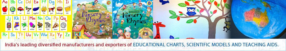
We are dealing in a broad range of political and physical maps of different countries and Indian states, charts related to different subjects,Educational Charts like World Political Maps, Illuminating Globes, Scientific Models, teaching aids, visual aids, primary study materials of different languages, rhymes, fruit, vegetable & human body part charts, globes, geographical outline maps, charts related to health & hygiene, portraits of great leaders & personalities, yoga guidelines and many more.
Our Professional Commitment
Since eight and a half decade, N. C. Kansil & Sons has seen nothing but excellent growth success, from our humble founding to the present, we have been recognized India's prominent manufacturer and exporter of World Political Maps, Illuminated Globes with a comprehensive range of Educational Aids and resources. With our collection of delightful medium called teaching aids, that help in transferring knowledge to kids, we have served to a number of educational institutions across the globe. Realizing the concept of learning with complete joy, our aim is to deliver interactive array of charts, maps and models to provide knowledge in interesting manner. With our offered products and exciting resources, we aim at creating inspiring and learning environment for pupils.
Our Strong Passion
Understanding the needs of modern-day teachers, we have continuously been expanding our product collection that includes World Political Maps and other teaching aids. Our products are designed as per customers' desires by using finest material under our manufacturing units. We collaborate with educationists and scholars, possessing in depth knowledge of subjects to deliver content. Apart from generating reliable content, we strive to make products visually delightful with help of our team of creative geniuses including graphic designers and programmers and other skilled professionals. Our unfazed commitments to design unique educational charts and world political maps are suitably complemented with our extensive knowledge and experience in the industry. Focusing on optimum client satisfaction, we aim at delivering highest standard teaching aids.
Key Facts
|
Business Type
|
Manufacturer, Exporter, Trader & Supplier
|
|
Export Percentage
|
20%
|
|
Sales Volume
|
Rs. 4.75 crores
|
|
No of Staff
|
12
|
|
Year of Establishment
|
1932
|
|
Export Markets
|
Worldwide
|
|
Monthly Production Capacity
|
As per requirement
|
Product Range
|
World Political Maps
|
Illuminating Globes
|
World Physical Maps
|
|
Synthetic Maps
|
Political State Maps
|
Physical State Maps
|
|
Geographical Outline Maps
|
TAMIL
|
Desk outline Maps
|
|
Health & Hygiene
|
First Aid
|
Yogasan
|
|
Diseases
|
AIDS
|
TELUGU
|
|
Thematic Maps of India
|
Education Teaching Materials
|
Food & Nutrition
|
|
Kannada
|
Physiology
|
Struggle for Indian Freedom
|
|
Physical Geography Charts
|
National Integration
|
Life Sketch of Great Men
|
|
Practical Geography Charts
|
Small geography charts
|
Genaral Charts
|
|
Malayalam
|
Great Leaders
|
Laminated Globes
|
|
Weather Maps of India
|
Gujarati
|
Marathi
|
|
Great Writers
|
WEATHER CHART
|
Changing Face of the Earth
|
|
Presidents of India
|
Urdu
|
English Teaching Charts
|
|
Man and Environment
|
Detailed Map Reading Charts
|
Anatomical Models
|
|
Geographical Models & Apparatus
|
Mathematics Junior kit
|
Mathematics Senior Kit
|
|
Human Physiology Charts
|
Laminated Chalk Board
|
Botany
|
|
Charts for Arithmetic
|
Laminated Marker Board
|
Notice Board
|
|
Preskograph Board
|
Zoology
|
Additional Items
|
|
Door Plate/ Desk Plate
|
Mathematics Charts
|
Chemistry
|
|
Goldsign Velvet Display Boards
|
Stands
|
Accessories
|
|
Portraits
|
Roll Up Plain Charts
|
Physics
|
|
Nursing Manikin
|
Gynae Models
|
General
|
|
Great Scientist
|
Nursing Charts
|
Alphabet Charts
|
|
Gems of Psychology
|
Nursery Rhymes
|
Moral Story
|
|
Telescopes
|
Milestones in Medical Sciences
|
Binoculars
|
|
Video Scope
|
Microscope
|
VISUAL TEACHING AIDS
|
|
Slide Projector
|
Pharmacy Teaching Portraits
|
Military Science Charts
|
|
Army Charts
|
Special Charts
|
Army Training Charts
|
|
Botany Models
|
Basic Essentials of Good Shooting
|
SPECIAL ROLL UPS
|
|
Zoology Models
|
Civil Defence Charts
|
Field Craft Charts
|
|
Models of Flowers
|
Scouting Charts
|
Life Sketch of Scientist
|
|
Genetics & Evolution Charts
|
Maps Of South India
|
Maps Of East India
|
|
Maps Of West India
|
Tourist Maps (Paper Edition)
|
Tourist Maps (Deluxe Edition)
|
|
District Map of Andhra Pradesh
|
District Map Of Chhattisgarh
|
Map Of Body Parts
|
|
State Map Outline
|
District State Map
|
Video CD's
|

 English
 Spanish
 French
 German
 Italian
 Chinese (Simplified)
 Japanese
 Korean
 Arabic
 Portuguese